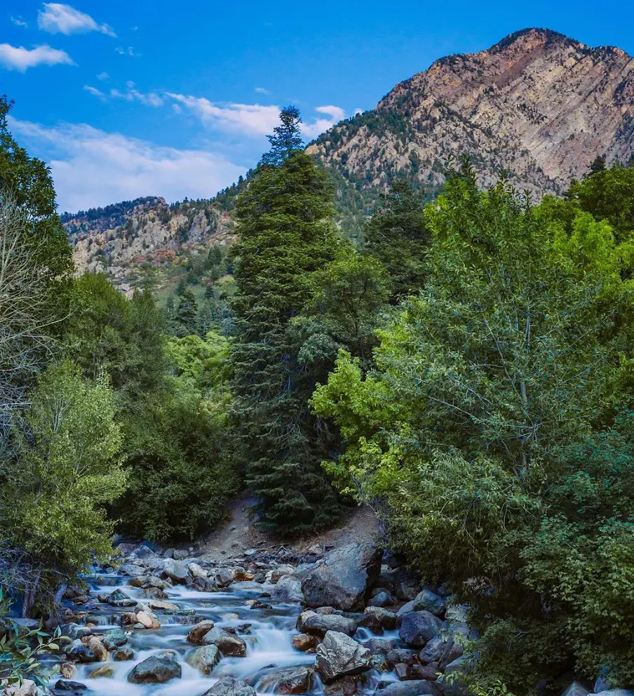
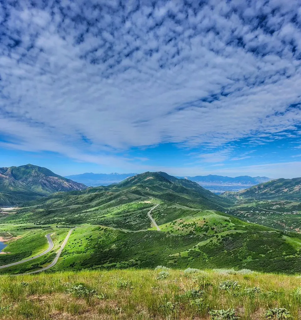
Salt Lake City consists of beautiful alpine lakes to incredible waterfalls along with historic peaks, so, there are tons of hiking trails to explore. In the peak of summer, go to the mountain and chill out on the shores of gorgeous alpine lakes.
To name some of the best trails and hikes in Salt Lake City, Lake Mary Trail, Living Room Lookout Trail, Donut Falls Trail, and Grandeur Peak East Trail are popular destinations. Along with these hiking trails, we have listed several others in this article.
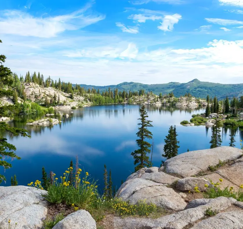
1. Lake Mary Trail
A fantastic summer hike and among the best hikes in Salt Lake City is the Lake Mary Trail, which leads to a stunning subalpine lake above Brighton Ski Resort. This is an excellent place for a picnic because of the slabs and boulders that surround the lake. However, be aware that dogs and swimming are not allowed at this lake because it is part of a protected watershed.
It's advisable to pack a lot of food and water for this day trip because people who aren't used to hiking at altitude may find it harder. It is not advised to take this route in the winter because it goes via Brighton Ski Resort. Brighton Resort has regulations and standards regarding wintertime uphill travel.
- Distance: 3.7 km
- Elevation gain: 245 m
- Estimated time: 1h 30m
- Difficulty level: Moderate
2. Living Room Lookout Trail
The Living Room Lookout Trail is one of the foothills' busiest paths as it leads to a breathtaking overlook including intriguing rock formations. The name of this trail comes from the common perception that certain rock formations resemble sofas and chairs. Along Colorow Road, street parking is abundant.
Red Butte Gardens and the Natural History Museum are located directly northwest of the parking lot. The track is somewhat small and for a while, it follows an ancient wash. There are a lot of trail junctions and offshoots along this route, so it's a good idea to download your map in advance.
Among the best hikes Salt Lake City during the summer, it's a good idea to pack plenty of water because this route offers little to no shade.
- Distance: 3.7 km
- Elevation gain: 298 m
- Estimated time: 1h 41m
- Difficulty level: Moderate
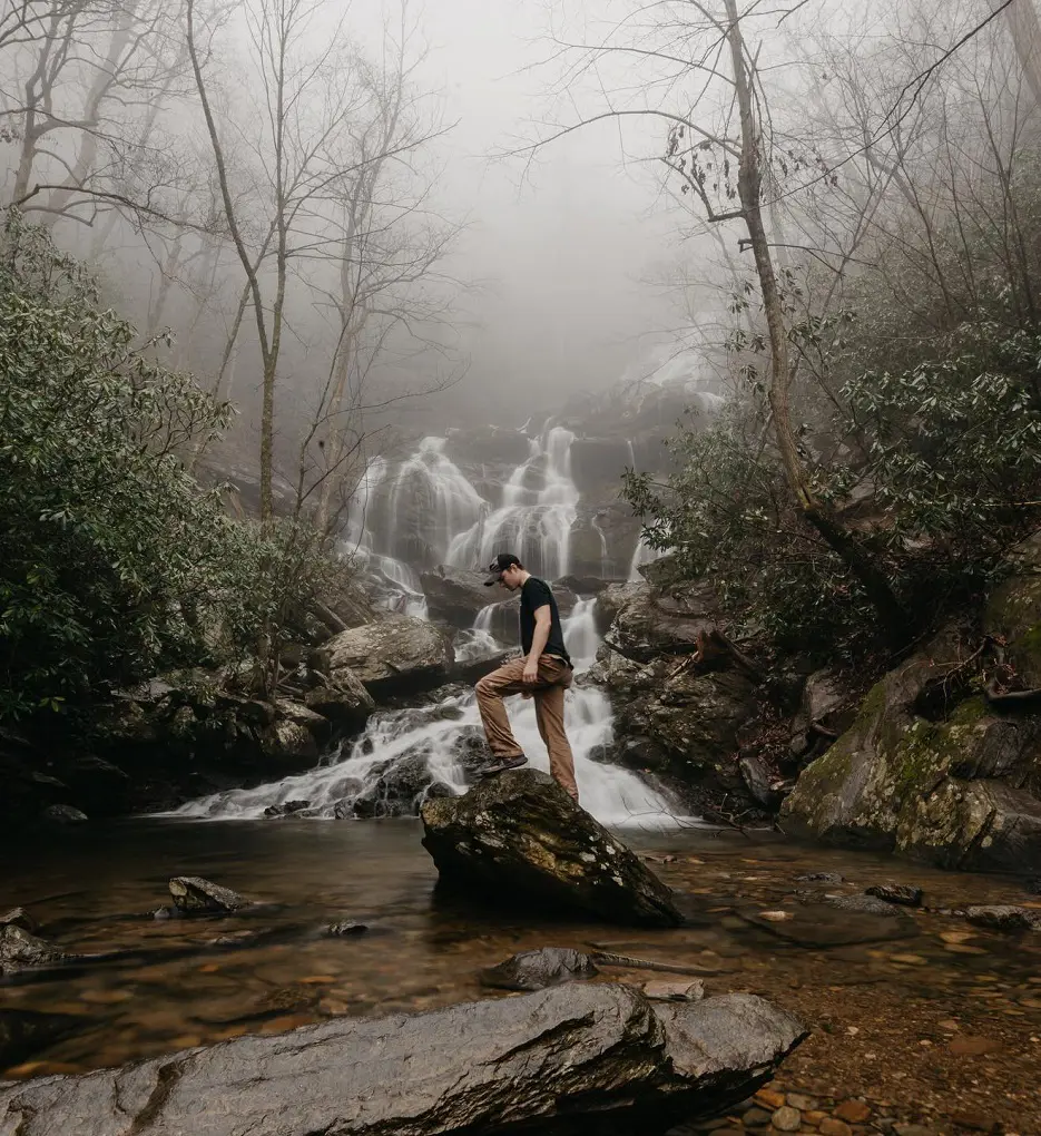
3. Donut Falls Trail
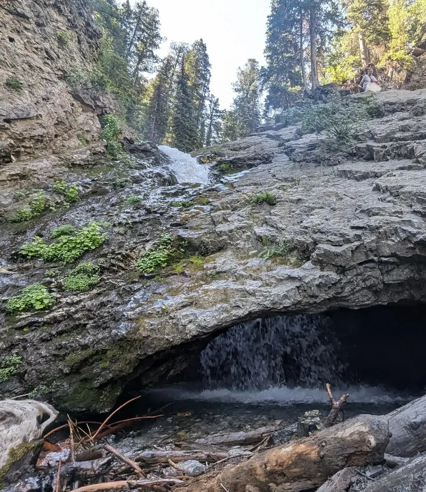
Donut Falls trails in Salt Lake City is a popular trail because of its family-friendly hiking, convenient location hiking near Salt Lake City, and exceptionally distinctive waterfall. The Donut Falls Trailhead is the starting point for your hike. The rock feature that resembles a doughnut hole gives the waterfall its name.
The falls trickle down the rocks after pouring through the opening into a little lake inside a cave. You have to park at the Mill D Trailhead during the winter or when the trailhead parking is full.
The hike gains about a mile round-trip from this alternative trailhead. You'll hike along a well-marked track to reach the falls. Soon, a wooden bridge will take you over a little creek and the trail stops after a short distance.
- Distance: 2.4 km
- Elevation gain: 89 m
- Estimated time: 44m
- Difficulty level: Easy
4. Grandeur Peak East Trail
Starting at the Church Fork Trailhead, the Grandeur Peak East Trail leads to the summit of Grandeur Peak. Your hike will begin at the end of the road leading to the Church Fork picnic area.
You will need to walk a little distance along the picnic area road to reach the trailhead if the picnic area is closed for the season. Hiking this path in the morning is highly recommended. The closer you approach the summit, the rougher the trail gets.
Before long, you'll be above the tree line and taking in the breathtaking vistas. Hikers recommend using crampons, snowshoes, or microspikes in the winter to do this hike.
- Distance: 9 km
- Elevation gain: 717 m
- Difficulty level: Hard
5. Cecret Lake Trail
A superb family-friendly hike, close to the Alta Ski Area, lies a stunning alpine lake that can be reached on the fantastic Cecret Lake Trail. At an elevation of about 9000 feet, the trek starts. From Salt Lake City, the trail is a well-liked day excursion.
It is highly suggested that hikers park at the Albion base area parking lot and hike the Upper Albion Meadows Trail due to the severely limited parking access at the Cecret Lake/Catherine's Pass Trailheads and to minimize congestion on the Summer Road and in the Upper Albion Basin parking areas.
It is not advised to travel this road during the winter as this trail is frequently covered in snow in the spring and fall, and it could be necessary to use snowshoes, microspikes, or other technical equipment to finish.
- Distance: 2.9 km
- Elevation gain: 142 m
- Estimated time: 1h 1m
- Difficulty level: Moderate
6. Avenue Twin Peaks
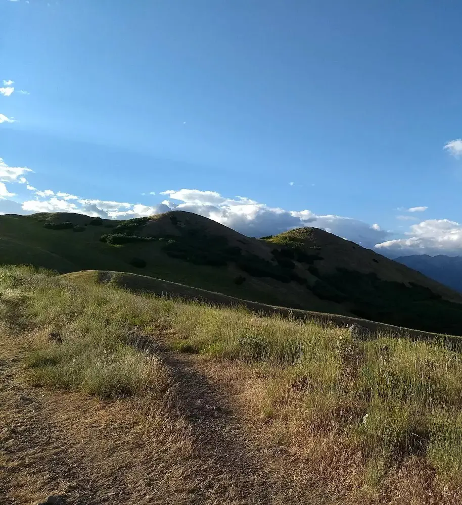
The Avenue's Twin Peaks offer breathtaking views and breathtaking sceneries, making it a fantastic spot to watch the sun set or rise. At the top are miles of rolling hills and mountain ranges, abundant with wildflowers in the spring.
As it is of average-length hike, it takes around 2 hours to complete and is a moderately challenging trail. This trail has some exposed areas with steep inclines. Dogs on leashes are permitted on this trail, which is a portion of the Bonneville Shoreline Trail (BST).
- Distance: 6.1 km
- Elevation gain: 304 m
- Estimated time: 2h 8m
- Difficulty level: Moderate
7. Ensign Peak Trail and Overlook
There is street parking available at the Ensign Peak trailhead, which is where this climb starts. Although the path is short, the ascent is steep and continuous. The trailhead offers historical details on how Native American tribes and Mormon settlers used the valley.
There is also an instructional signage explaining the monument at the top. The hike is rewarded with breathtaking views of the neighboring mountain ranges, the Great Salt Lake, and the entire Salt Lake Valley.
This climb ascends a rugged mountain with little, if any, options for shade. Because this is a multi-use trail, please observe trail etiquette and give hikers, dog walkers, and bicycles some space.
- Distance: 1.4 km
- Elevation gain: 114 m
- Estimated time: 39m
- Difficulty level: Moderate
8. Sunset Peak via Brighton Lakes Trail
Situated close to Salt Lake City, Utah, this 9.3 km out-and-back hike provides a demanding yet rewarding hiking experience. It is rated as a challenging route and takes about 3 hours and 44 minutes to finish on average.
The best time to explore this trail is between May and October. Please be aware that this trail is off-limits to pets. The breathtaking blooms and chance to see wildlife, including moose, have been highly appreciated by hikers. Hence it is crucial to be ready for windy and cold weather at the peak.
- Distance: 9.3 km
- Elevation gain: 602 m
- Estimated time: 3h 44m
- Difficulty level: Hard
9. Twin Lakes Trail
This hike leads to Twin Lakes Reservoir and Silver Lake, both of which have breathtaking views and are encircled by mountains. You'll hike through scenic meadows and along stretches of boardwalk. You must park in a lot at the Silver Lakes information center to access this route.
talking about the conditions, there are a few muddy areas at first, particularly following rain. August is usually a great month to hike because of the warm, dry weather that trails may have. Dogs are not allowed on this trail.
- Distance: 3.7 km
- Elevation gain: 234 m
- Estimated time: 1h 28m
- Difficulty level: Moderate
10. Lower Mill B North Fork Trail
Lower Mill B North Fork Trail is a 3.5-kilometer out-and-back trail in the vicinity of Salt Lake City, Utah. It is typically regarded as a moderately difficult route, taking 1 hour 34 minutes on average to finish. Hiking, cross-country skiing, and bird watching are all highly popular in this area.
The route is lovely to explore at any time of year and is open year-round. Dogs are not permitted on this trail, despite the short but steep hike's lovely scenery and well-marked path.
Hikers observed that although there are places on the trail that offer shade and relief from the heat, it may occasionally be congested, especially near the parking lot. Temperatures in August are often warmer along the road and cooler in the trail's shady sections.
- Distance: 3.5 km
- Elevation gain: 273 m
- Estimated time: 1h 34m
- Difficulty level: Moderate
11. Jacks Mountain
Jack's Mountain which is another best hiking trails in Salt Lake City is also known by another name, Jack's Mailbox is one of the stunning peaks close to Salt Lake City. There is a very particular and unusual tale connected to this mount.
Jack Edwards, a youngster, passed away from leukemia back in 1995. Jack's parents erected two mailboxes in memory of their son and scattered his ashes atop this mountain as a memorial. Ever since, it has become customary for the person who ascends the peak to write a brief note for Jack, the young boy.
The trail's condition changes with the seasons, with mud, snow, and ice cycling through it and offering a different challenge each time. Therefore, it is strongly advised to check the weather before making this excursion.
- Distance: 4 km
- Elevation gain: 398 m
- Estimated time: 2h 5m
- Difficulty Level: Hard
12. Big Cottonwood Canyon Scenic Byway
The Big Cottonwood Canyon Scenic Byway provides an amazing trip in a beautiful natural setting. This dramatic 23.5 km trip goes through verdant forests, glistening streams, and towering granite cliffs.
Visitors can take in breathtaking panoramic views of the surrounding valleys and mountains along the route. Due to its accessibility to a wide range of recreational opportunities, the byway is a well-liked location for outdoor enthusiasts.
Among the many things to do in the area are hiking, biking, fishing, and camping. The canyon is a famous winter destination because it is home to several well-known ski resorts.
- Distance: 23.5 km
- Elevation gain: 1,204 m
- Difficulty level: Easy
13. The Living Room Loop
There is sufficient street parking at Colorow Road, where this loop begins, so start the path by ascending the trail from the living room. Due to its popularity, it is considered among the good hikes in Salt Lake City, there's a good chance you'll run with other trail users while traveling this path.
There are parts of this high trail where there is loose rock, so, as soon as you enter the living area, you will be treated to stunning eastward views of the valley. You will also view what is called the living room, which is a naturally occurring rock formation that resembles a couch.
- Distance: 4.5 km
- Elevation gain: 306 m
- Difficulty level: Moderate
14. Silver Lake Loop Trail
Silver Lake Loop Trail is a relatively short and easy trail but it offers a scenic loop, providing stunning views of the surrounding landscape. The trail is approximately 1.4 kilometers long with a minimal elevation gain of 17 meters, making it suitable for hikers of all ages and fitness levels.
While the trail is generally easy, hiking in Salt Lake City Utah this trail it's important to note that it traverses terrain prone to avalanches, especially during winter months.
Hikers should exercise caution and be aware of potential hazards, especially in areas marked as avalanche risk zones. The estimated completion time for the trail is approximately 19 minutes.
- Distance: 1.4 km
- Elevation gain: 17 m
- Estimated time: 19m
- Difficulty level: Easy
15. Big Beacon Mount Wire Trail
Mt. Wire, often known as Big Beacon by locals, is a notable foothill mountain located just east of Salt Lake City's downtown. If you'd like to gain an additional twenty-five feet of altitude, you can ascend the historic airway beacon situated atop Mount Wire.
Although Mt. Wire is a relatively low-elevation summit, it offers an amazing 2,000 vertical foot spring climb with breathtaking vistas in all directions, many wildflowers, and animals, including the rare mountain lion or rattlesnake.
Typically, the summit is accessible for hiking in April without any snowfall, making it a great way to prepare for the larger mountains.
- Distance: 7.1 km
- Elevation gain: 645 m
- Estimated time: 3h 30m
- Difficulty level: Hard
16. Lake Solitude Trail
For those who enjoy the great outdoors, Salt Lake City, Utah's Lake Solitude Trail provides a peaceful haven. Renowned for its user-friendliness, this 5.1-kilometer out-and-back track is a favorite among hikers, cross-country skiers, and snowshoers.
The tranquil beauty of the path is its main attraction. There is a serene atmosphere created by the surrounding natural scenery, which is made up of towering trees and glistening waters. Admire spectacular views of Lake Solitude, a glistening body of water that reflects the surrounding mountains, as you make your way along the walk.
- Distance: 5.1 km
- Elevation gain: 135 m
- Estimated time: 1h 23m
- Difficulty level: Easy
17. 10420 Peak
This route's trailhead was relocated in 2020. Guardsman Pass's former trailhead is now just a place to drop people off and enjoy the vista. It is now closed from Bloods Lake to Guardsman Pass.
Dogs are permitted on this route for the most part, although not at Bloods Lake or along the trail segment that leads there. Dogs are permitted on this trail and as it is east of the Salt Lake City watershed, but please be mindful to not bring dogs into the watershed areas near Brighton, Big Cottonwood, and Little Cottonwood Canyons.
- Distance: 8 km
- Elevation gain: 387 m
- Estimated time: 2h 46m
- Difficulty level: Moderate
18. Little Mountain Trail
This trail is crowded and easy to travel, making it a fantastic choice for a family-friendly, somewhat moderate, and safe hike. It starts with a quick, sharp walk up a hill and then levels out. Although there is no shade and some of the pathways are very tight, this is still a wonderful jogging trail.
However, you may take in lovely vistas of the reservoir and Emigration Canyon. The moderate-level trail takes about two hours to complete.
- Distance: 6.1 km
- Elevation gain: 262 m
- Estimated time: 1h 59m
- Difficulty level: Moderate
19. Broads Fork Trail
The challenging yet rewarding Broads Fork Trail in the center of Salt Lake City draws hikers looking for a challenging trail with amazing views.
Renowned for its strenuous climb, this 7.2-kilometer track takes hikers through a variety of environments, from deep forests to alpine meadows, before reaching a vantage point with expansive views of the surrounding mountains.
Hikers starting this trail will gain 643 meters in elevation, thus physical stamina and preparation are required. The demanding nature of the course is highlighted by the anticipated completion time of 3 hours and 31 minutes.
- Distance: 7.2 km
- Elevation gain: 643 m
- Estimated time: 3h 31m
- Difficulty level: Hard
20. Mount Olympus Pipeline Trail
The scenic and easily accessible Mount Olympus Pipeline Trail in Salt Lake City provides a lovely natural relaxation. The trailhead is located at the Burch Hollow parking area off Mill Creek Canyon Road. From there, hikers follow a path that is largely level with gradual inclines and drops until it ends.
The trail offers relief from the summer sun due to the trees' thick canopy. Hikers are rewarded with breathtaking views of the surrounding terrain along the route.
The trek can be continued to the 8,299-foot summit of Grandeur Peak for those looking for a more brutal journey. Hikers are encouraged to carry mosquito repellent to guarantee a relaxing and pleasurable trip.
- Distance: 4.8 km
- Elevation gain: 136 m
- Estimated time: 1h 19m