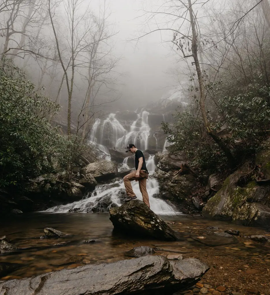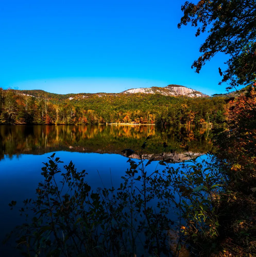
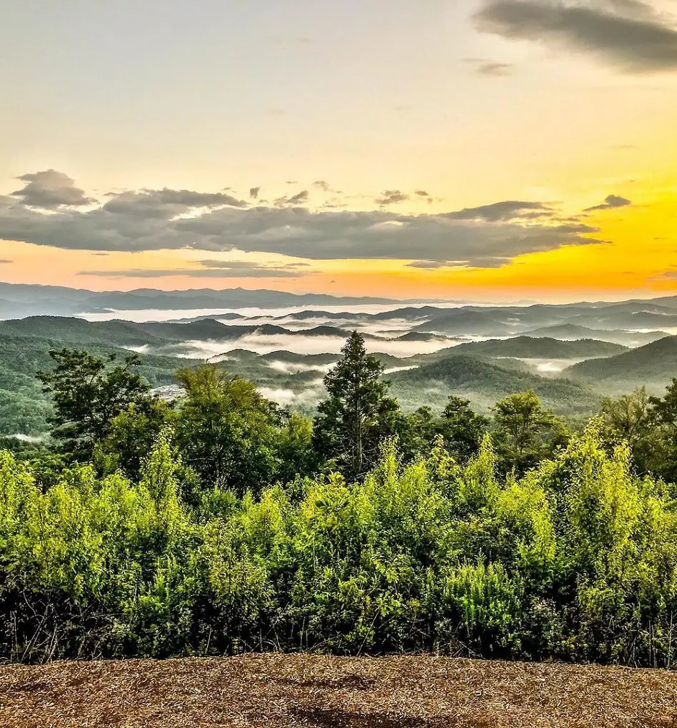
South Carolina, commonly known for its beaches, parks, theme parks, and historic sites is not uncommon for hiking trails. It is one of the most beautiful states in the United States, and Blue Ridge Mountain is one of its major perks as it offers amazing views and landscapes.
To name some of the best trails and hikes in South Carolina, the most popular ones are Table Rock Trail, Boardwalk Loop, Sulphur Springs Trail, Yellow Branch Falls Trail, Raven Rock Loop Trail, and many more.
1. Table Rock Trail
- Distance: 11.1 km
- Elevation Gain: 706 m
- Route Type: Out & back
- Dog Friendly: Yes
- Difficulty Level: Hard
One of the most difficult trails on the list, the Table Rock Trail is quite a long journey and should take around 4 and a half hours to complete. Undoubtedly one of the best hikes in South Carolina, this trail has some challenging uneven rock stairs as well as logs up to the summit.
Hence, once you reach the summit, you will forget about all the challenges and hard work you have put in to get there because of the astonishing scenery you will see. On your way, you rather stop at two places, the Carrick Creek Falls along the Governor's Rock overlook, as they are equally beautiful.
2. Boardwalk Loop
- Distance: 3.7 km
- Elevation Gain: 4 m
- Route Type: Loop
- Dog Friendly: Yes
- Difficulty Level: Easy
This quite short and easy trail will just take you no more than 45 minutes to complete as its uphill climb is only 4 meters. The Boardwalk Loop winds through a varied old-growth forest, rising nearly 6 feet above the ground.
The tourist center should include a self-guided booklet that you may use to learn more about the natural resources in the region. Listen for the woodpeckers' hammering noise from the towering trees overhead. You may stroll around Weston Lake, a historic Congaree River channel, on the boardwalk.
3. Sulphur Springs Trail
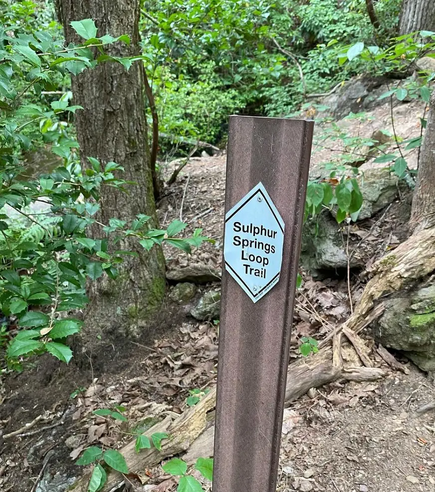
- Distance: 6.4 km
- Elevation Gain: 210 m
- Route Type: Loop
- Dog Friendly: Yes
- Difficulty Level: Hard
Another challenging trail, the Sulphur Springs Trail is 3.9 miles long with an uphill climb of around 210 meters, and it would take around 2 hours to complete. The hike offers sensational views of a lake and cascades while it follows a creek.
The route is quite simple for the remainder of it, but there are some inclines in the first mile. The majority of the path is shady and well-maintained. But since the trailhead becomes busy, it's best to get going early. This is an excellent path overall with a couple of tricky uphill sections.
4. Yellow Branch Falls Trail
- Distance: 5.0 km
- Elevation Gain: 145 m
- Route Type: Out & back
- Dog Friendly: Yes
- Difficulty Level: Moderate
A strenuous one-hour and 30-minute hike leads to Yellow Branch Falls, which culminates in a stunning 50-foot vertical waterfall with several smaller cascades. Starting from the picnic area off of SC 28, the trail heads towards the falls by following a connecting trail that merges with the Yellow Branch Falls Trail.
You will meander across multiple creeks and pass through groves of stately hardwood throughout the route. When the trees are bare in the winter, you can see the Town of Walhalla in the distance. On this trek, the National Forest Service advises wearing sturdy shoes and exercising extreme caution in rainy weather because the path hugs the margins of steep ravines.
5. Rainbow Falls Trail
- Distance: 7.1 km
- Elevation Gain: 360 m
- Route Type: Out & back
- Dog Friendly: Yes
- Difficulty Level: Moderate
The Rainbow Falls Trail is a moderately difficult trail that takes around 2 hours and 30 minutes to complete with 360 meters of uphill to climb. As you ascend several steps, the route then becomes steeper from its simple beginning at the trailhead.
Hence, a significant quantity of elevation is gained in a short length of time. Nevertheless, the breathtaking vistas of the falls make the exhausting journey worthwhile. There are several difficult terrain spots, such as rocky ones where you have to be careful where you step.
6. Raven Rock Loop Trail
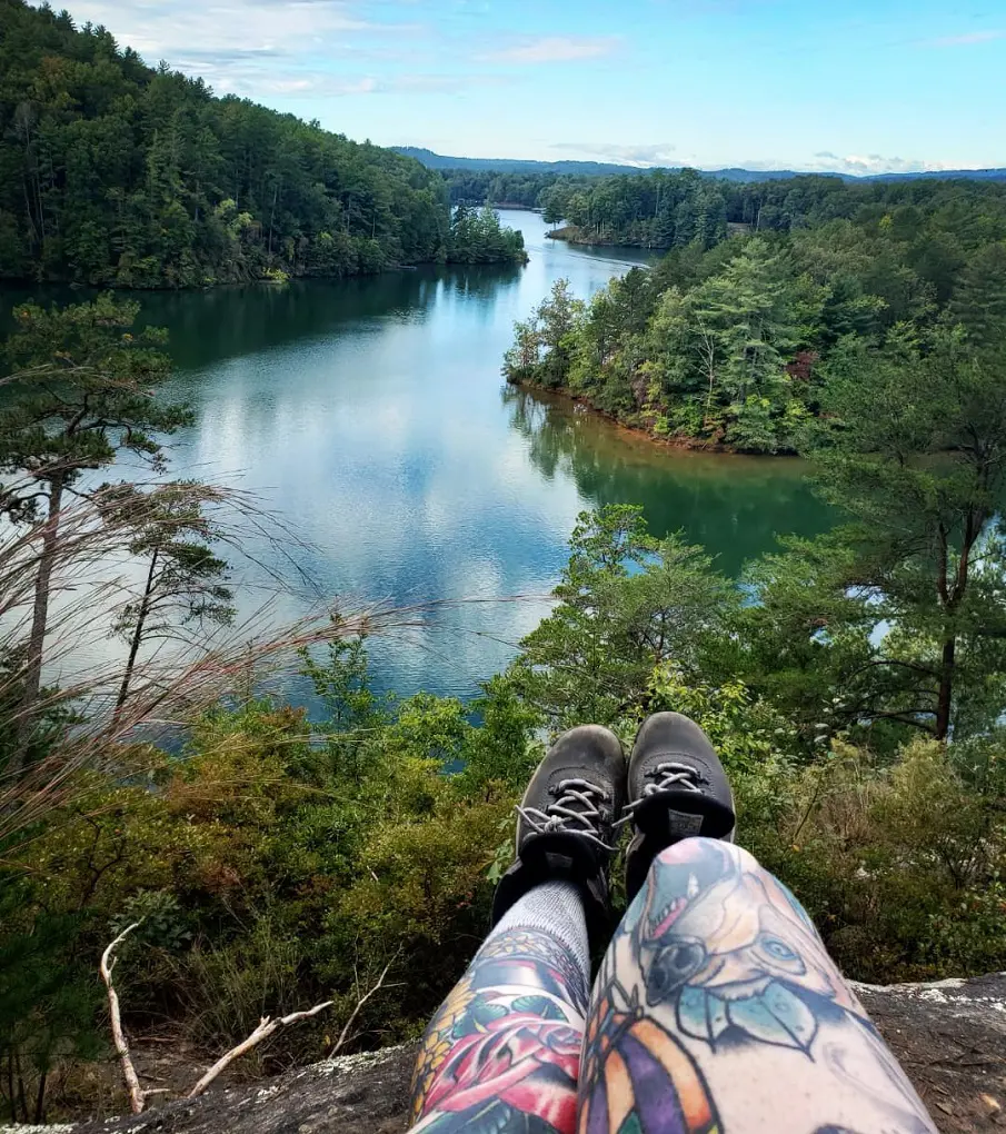
- Distance: 6.9 km
- Elevation Gain: 272 m
- Route Type: Loop
- Dog Friendly: Yes
- Difficulty Level: Moderate
The Raven Rock Loop Trail should take around two hours and ten minutes to do, is the ideal retreat since it has a lakefront camping, a natural bridge with rocky outcrops, and a lovely stream crossing. The walk begins gently and passes over a natural granite bridge to cross Poe Creek.
The next stretch climbs until it reaches the top of a steep valley. After that, you'll ascend to a ridge and essentially follow it downhill to Lake Keowee. The peninsula has a fantastic campground, but you'll need to make a reservation at the ranger station in advance. There is a wonderful river crossing and a lot of climbing and severe descent on the way back.
7. Weston Lake Loop Trail
- Distance: 7.6 km
- Elevation Gain: 5 m
- Route Type: Loop
- Dog Friendly: Yes
- Difficulty Level: Moderate
The Weston Lake Loop Trail which is a 4.7-mile journey that takes around 1 hour and 20 minutes is a dog-friendly trail and it starts by going through a varied old-growth forest on a high boardwalk. You will also get to see a variety of wildlife on this trail.
You will eventually get off the boardwalk and continue down the Weston Lake Trail, which goes beside Cedar Creek and Weston Lake. Along the route, there are plenty of seats where you may pause for a snack and admire the view.
8. Raven Cliff Falls and Dismal Trail Loop
- Distance: 12.2 km
- Elevation Gain: 643 m
- Route Type: Loop
- Dog Friendly: Yes
- Difficulty Level: Hard
This route offers an amazing journey by combining the Raven Cliff Falls Trail, the Gum Gap Trail, the Natureland Trust Trail, and the Dismal Trail. It will take 4 hours and 30 minutes to do this lengthy hike, so start by hiking from path Raven Cliff Falls to route Gum Gap.
Proceed towards Matthews Creek and cross the suspension bridge to reach Natureland Trust from Gum Gap. The Cathedral Formation and a fantastic ledge break are located along the route. After using the cables to cross Matthews Creek, begin the treacherous switchbacks on the Dismal Trail that will lead you back to Raven Cliff Falls and the parking area.
9. Raven Cliff Falls Trail
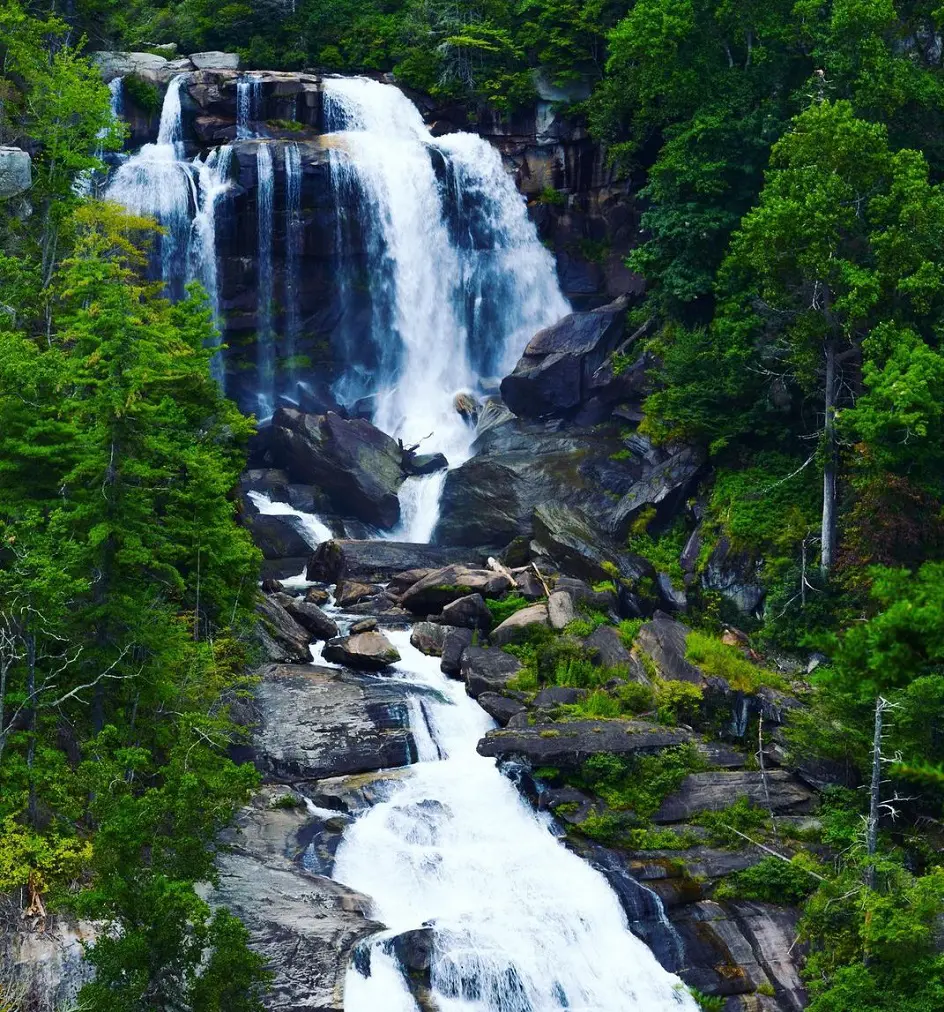
- Distance: 6.1 km
- Elevation Gain: 211 m
- Route Type: Out & back
- Dog Friendly: Yes
- Difficulty Level: Moderate
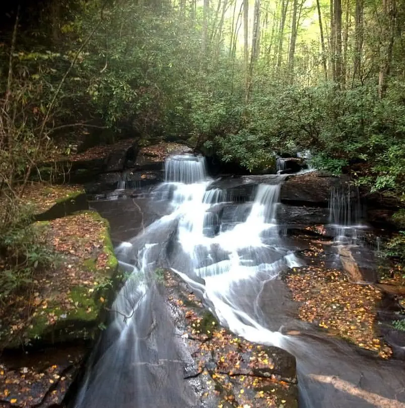
Standing 420 feet tall, Raven Cliff Falls is the king of South Carolina waterfalls. At the Blue Ridge Escarpment, close to Caesars Head, Matthews Creek plunges off Raven Cliff Mountain. The Blue Ridge Mountains, which are a component of the Appalachian Mountains, abruptly descend 2,000 feet to the Piedmont below at the escarpment.
There are several falls in the region because of this abrupt plunge in geology. One of the state's most picturesque and most photographed waterfalls is Raven Cliff Falls. The ravens that breed in the tall rocks that compose the falls are the reason for the name.
10. Carrick Creek Loop
- Distance: 3.2 km
- Elevation Gain: 120 m
- Route Type: Loop
- Dog Friendly: Yes
- Difficulty Level: Moderate
This beautiful loop takes around 1 hour to complete with the uphill climb of 120 meters, it is a moderately challenging trail. The Carrick Creek Nature Center, which provides a variety of activities, is where you'll find the trailhead.
As the route breaks off from a few others, be careful to consult the map at the trailhead. There will be many stream crossings on the path. The starting waterfall is breathtaking and conveniently located. All things considered, this track is a great option for a family hike.
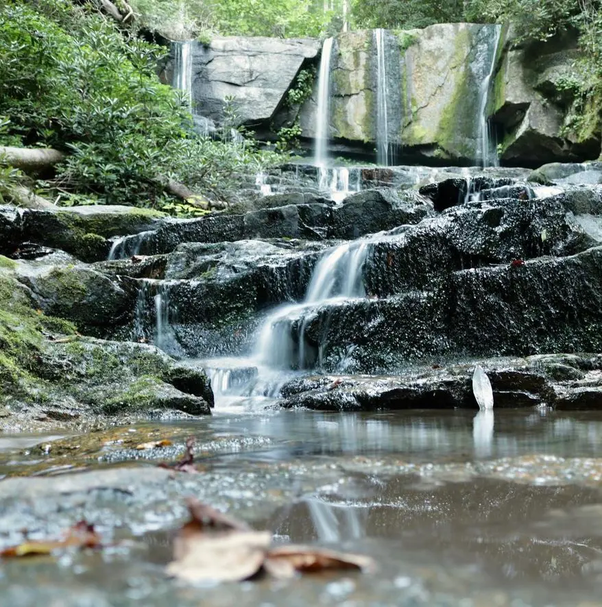
11. Brasstown Falls
- Distance: 1.3 km
- Elevation Gain: 23 m
- Route Type: Out & back
- Dog Friendly: Yes
- Difficulty Level: Easy
Among the shortest and easiest trails, the Brasstown Falls is not even a mile long and has an uphill climb of 23 meters. It should take no more than 20 minutes to complete but this short hike offers stunning views of the main falls and Little Brasstown Falls. This route is great for the whole family because it has something to offer everyone.
Although the route is well-maintained, there are some narrow and steep sections, as well as steps and drop-offs. Even though dogs are permitted in this region, it is not recommended to bring them on this path because of the amount of scrambling that is necessary, which may be challenging for most canines.
12. Sassafras Mountain via Foothills Trail
- Distance: 13.5 km
- Elevation Gain: 666 m
- Route Type: Out & back
- Dog Friendly: Yes
- Difficulty Level: Hard
The 8.3 miles Sassafras Mountain via Foothills Trail is among the hard trails and has an uphill climb of 666 meters. It should take around 4 hours and 45 minutes to complete the trail. You need to cross Highway 178 to get to the trailhead. If you don't want to drive up the carriage road, you may park here as well, right beneath the Foothills Trail sign.
People of all ages can use this portion of the FHT. The trek offers an amazing experience of the terrain as it passes through thick forests. The hike is a wonderful stroll through the gorgeous landscape with a ravine. There's a fantastic boulder field with natural cover in case it rains.
13. Reedy River Falls Loop
- Distance: 1.6 km
- Elevation Gain: 32 m
- Route Type: Loop
- Dog Friendly: Yes
- Difficulty Level: Easy
The simple yet short Reedy River Falls Loop is a less than 30-minute long journey with 32 meters of uphill climb. Despite being so near to Greenville's center, this lovely and tranquil hike gives you the impression that you are in the outdoors.
The downtown Reedy River is a wonderful location for a stroll and picnic. The walk passes under two bridges and offers stunning views of the Arboretum Falls. Signs are warning against swimming due to the high level of germs in the water.
14. Lee Falls Trail
- Distance: 4.7 km
- Elevation Gain: 92 m
- Route Type: Out & back
- Dog Friendly: No
- Difficulty Level: Moderate
The Lee Falls Trail is a moderate-level difficulty trail that is located in Sumter National Forest. While the trail's initial hike is clearly marked and easy to follow, certain parts may be invasive, particularly in the summer. Wearing long pants is strongly advised for safety.
The route may end at the creek fork, but if you continue upstream a little distance, you'll find that the trail continues on the right bank.
15. Jones Gap Loop Trail
- Distance: 18.8 km
- Elevation Gain: 613 m
- Route Type: Loop
- Dog Friendly: Yes
- Difficulty Level: Hard
The Jones Gap Loop Trail is an 11.8-mile-long trail that has an uphill climb of 613 meters and it should take you around 5 and a half hours to complete. The steep elevation and frequently slick mossy rocks make the descent down Coldspring Branch Trail difficult.
But as you get to Jones Gap Trail, the gradient toward Rainbow Falls gets less steep and simpler to follow. Along the journey, you'll witness numerous additional waterfalls, and the falls themselves are breathtaking. Prepare yourself for a rugged workout because the Jones Gap Trail return hike is a steady rise until you reach the ridge.
16. Caesars Head Overlook Trail
- Distance: 0.5 km
- Elevation Gain: 14 m
- Route Type: Out & back
- Dog Friendly: Yes
- Difficulty Level: Easy
This short journey of around 500 meters on Caesars Head Overlook Trail is among the easiest ones on the list. Accessible via US 276, Caesars Head State Park is a park located in northern Greenville County, South Carolina, bordering Transylvania County, North Carolina.
One of the highest peaks in Greenville County, the named rock formation is a granitic gneiss outcrop situated approximately 2,000 feet above the Piedmont below. It is located on the Blue Ridge Escarpment of the Blue Ridge Mountains, 3,208 feet above sea level.
Although the meaning of the term "Caesars Head" is unclear, the protrusion was most likely called after a dog owned by an early climber. As part of the Mountain Bridge Wilderness, the state Department of Parks, Recreation, and Tourism jointly manages Caesars Head State Park and Jones Gap State Park.
17. Issaqueena Falls Trail
- Distance: 0.5 km
- Elevation Gain: 27 m
- Route Type: Out & back
- Dog Friendly: Yes
- Difficulty Level: Moderate
Issaqueena Falls Trail is one of the shortest but moderately difficult trails, which is 500 meters long and has an uphill climb of 27 meters. Since it is a dog-friendly trail, you can bring your dogs with you but you need to keep them on a leash for the safety and comfort of other people that have come to the trail.
Hence, you will have to pay $5 as a parking fee if you come there in your vehicle. Moreover, January to November is the best time to visit the Issaqueena Falls Trail.
18. Oakridge Trail
- Distance: 10.8 km
- Elevation Gain: 5 m
- Route Type: Loop
- Dog Friendly: Yes
- Difficulty Level: Easy
The Oakridge Trail, which is located at Congaree National Park is an easy journey of 6.7 miles as it would take around 2 hours to complete. This path offers you a sample of all that Congaree National Park has to offer, including two forest lakes, secluded areas of the park, and both high and low boardwalks over the swamp.
Also watch out for animals, such as deer, wild pigs, and several bird species. This path is lined by a wide variety of tree species, including massive uprooted trees, massive deciduous trees, and large pine trees. There is nearly constant shade along the walk.
19. Virginia Hawkins Falls
- Distance: 4.2 km
- Elevation Gain: 128 m
- Route Type: Out & back
- Dog Friendly: Yes
- Difficulty Level: Easy
The Virginia Hawkins Falls starts at the Laurel Valley Trailhead is another easy trail that is 2.6 miles long and has an uphill climb of 128 meters. There are several steps on this hike, along with numerous climbs and descents. There's no need to worry about getting lost because the route is clearly defined.
Moreover, they allow dogs on this trail but they are strictly required to keep on a leash for the safety and comfort of other visitors.
20. Brissy Ridge Trail loop
- Distance: 3.5 km
- Elevation Gain: 148 m
- Route Type: Loop
- Dog Friendly: Yes
- Difficulty Level: Moderate
There are several steep climbs and descents on the ridge-side Brissy Ridge Trail. This yellow-blazed path starts at the top parking lot and goes through South Carolina's scenic upstate. The Sulphur Springs route will split off at the top of the first steep slope.
The route winds through trees of oak and pine along the hills. After crossing the access road, the trail ascends gradually to Brissy Ridge, which is the toughest part of the route. On a clear, bright day, a spectacular view may be observed, while seasonal vegetation may obscure these vistas.