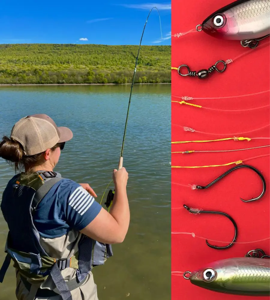
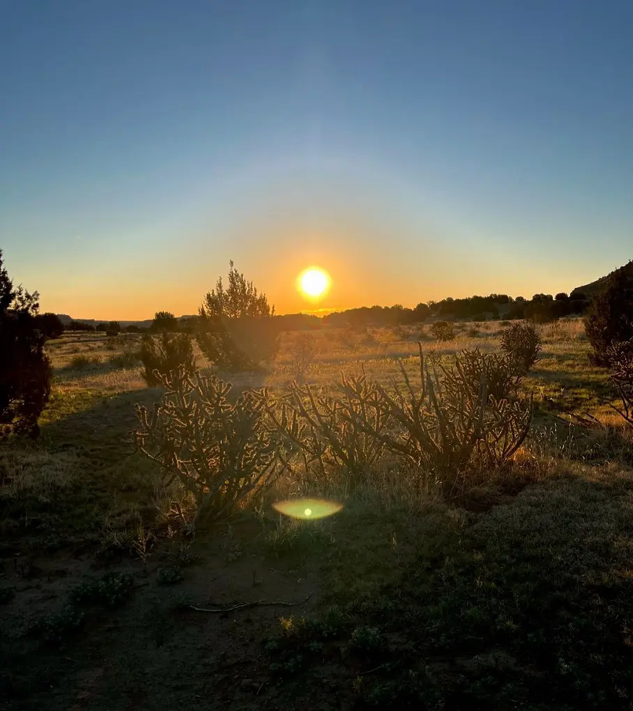
Oklahoma is not only famous for being the producer of natural gas, oil production, and agricultural products but also for its mountain ranges. This state from the south-central region has plenty of hiking trails to offer.
Friends Trail Loop, Turkey Mountain Via Yellow Loop, Skyline Trail, and Cedar Bluff Nature Trail, are just some of the most common trails for hiking in Oklahoma. Moreover, this article brings you to discover the 15 best trails and hikes in Oklahoma.
1. Friends Trail Loop
- Distance: 2.4 km
- Elevation Gain: 87 m
- Route Type: Loop
- Dog Friendly: Yes
- Difficulty Level: Moderate
The Friends Trail Loop is a moderately challenging hiking trail in Oklahoma that is 1.4 miles long with an uphill climb of 87 meters. It won't take more than 45 minutes to complete it but will surely depend upon the speed and other things.
Like most of the trails, the Friends Trail Loop also has amazing views of the lake through rolling hills. Not just the beautiful views the trail is equally well maintained and you won't have to keep looking for shades as it has lots of them. It is also a dog-friendly trail so bring them with you but keeping them on a leash is a must.
2. Turkey Mountain via Yellow Loop
- Distance: 6.0 km
- Elevation Gain: 113 m
- Route Type: Loop
- Dog Friendly: Yes
- Difficulty Level: Moderate
The Turkey Mountain through Yellow Loop is a perfect hiking option because of its beautiful landscape and its moderately challenging difficulty level. It has several great hiking routes and is only ten minutes from Tulsa's downtown.
It's simple to explore the region because there are small routes connecting these trails. Despite some steep ascents, the yellow loop on the east side of the mountain is ideal for a variety of leisure activities. Beautiful trees provide adequate shade along the route, shielding it from the sun.
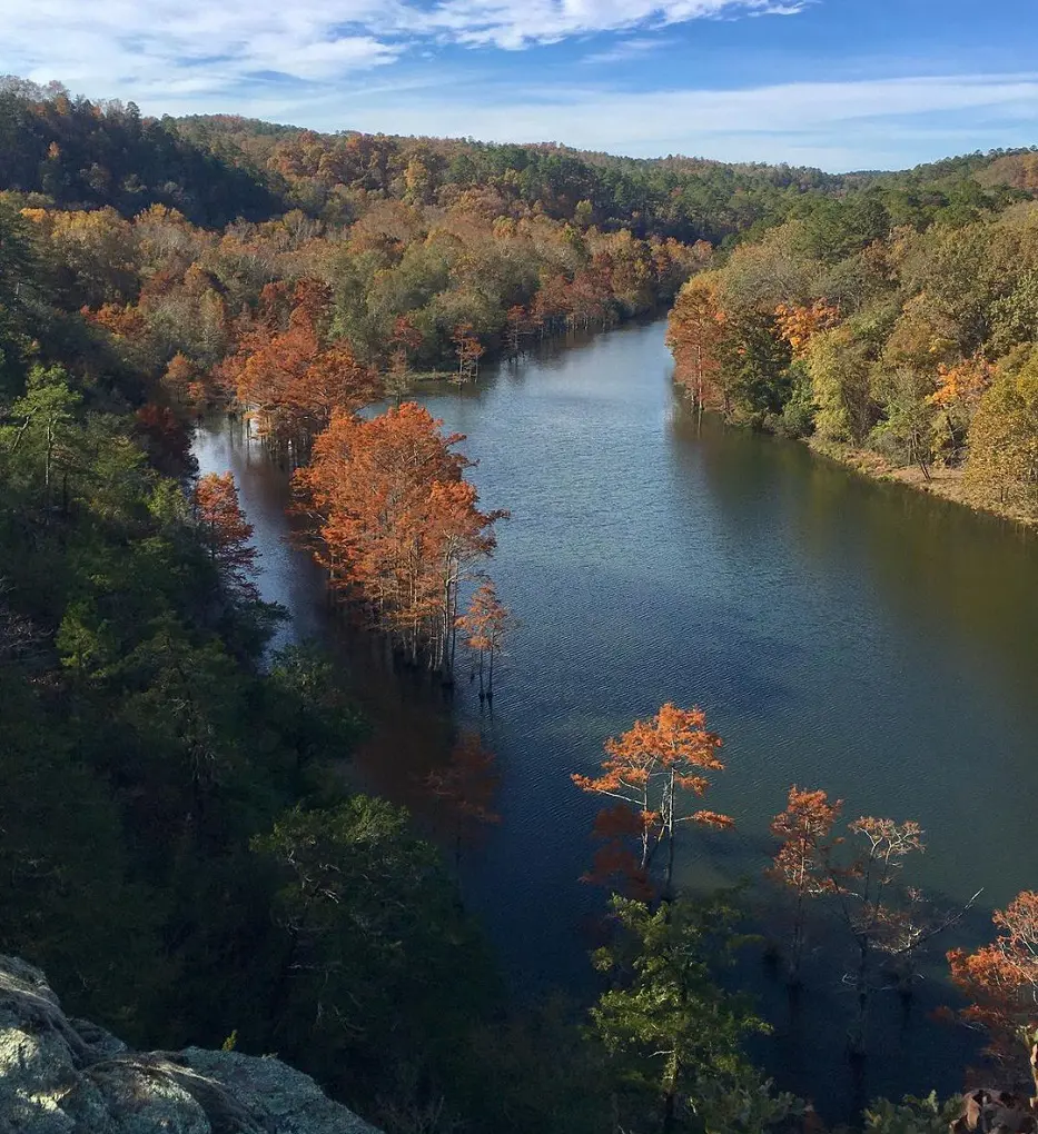
3. Skyline Trail

- Distance: 13.8 km
- Elevation Gain: 507 m
- Route Type: Loop
- Dog Friendly: Yes
- Difficulty Level: Hard
One of Beavers Bend State Park's longest and most popular trails is the Skyline Trail. Although the path may be very satisfying, it can also be very challenging, especially because of its high inclines. It is advised to wear appropriate footwear while starting this walk.
Hikers should also be mindful of the multiple potentially dangerous river crossings, particularly in the wake of a significant downpour. The path may not always be clear, thus it is important to look for trail markings. The route ends at a road that returns to the trailhead.
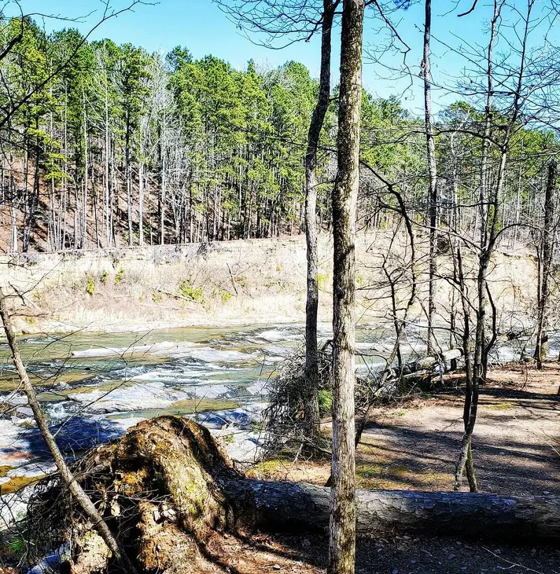
4. Cedar Bluff Nature Trail
- Distance: 1.3 km
- Elevation Gain: 50 m
- Route Type: Loop
- Dog Friendly: Yes
- Difficulty Level: Moderate
The Cedar Bluff Nature Trail is a very short but interesting one as it takes less than 30 minutes to complete and it is near the Lower Mountain Fork River miniature golf course and kayak rentals, and it's just across from Dogwood Campground.
The path passes the Mountain Fork River and is a somewhat simple trek with little elevation increase. To keep on the route, look for the blue trail markers on the trees. The junctions with Skyline Trail and Deer Crossing are indicated by red tree blazes. This moderately challenging trail is a dog-friendly trail so you can bring your furry friends with you.
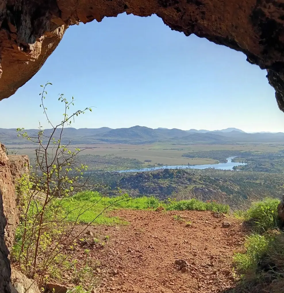
5. Elk Mountain Trail
- Distance: 3.7 km
- Elevation Gain: 174 m
- Route Type: Out & back
- Dog Friendly: Yes
- Difficulty Level: Moderate
Elk Mountain Trail is a 2.29-mile long trail that is moderately difficult but a gorgeous one with an uphill climb of 174 meters and should take around 45 minutes to complete. This is an off-the-beaten-path, challenging journey that calls for some navigational expertise.
Here in this peaceful area, one may enjoy breathtaking vistas and preserved landscapes. Under the US Fish and Wildlife Service's management, the Charon's Garden Wilderness Area is a portion of the Wichita Mountains Wildlife Refuge in southwest Oklahoma. When visiting this lovely location, please stay on authorized routes and be cautious of fragile ecosystems.
6. Beaver Lodge Nature Trail
- Distance: 4.8 km
- Elevation Gain: 75 m
- Route Type: Out & back
- Dog Friendly: Yes
- Difficulty Level: Moderate
The Beaver Lodge Nature Trail is among the best hiking places Oklahoma with a moderate difficulty level and it should take little more than 1 hour to complete the trail. Hence, there is no loop around the trailhead on the Beaver Lodge hike; it is a one-way hike.
You may enter it right below the spillway or below the hydroelectric dam. Except for a brief stretch that connects a region that was damaged by flooding, it is generally broad. It is advised that you continue on the broad, level track until it gets too steep or too tight. Just turn around and return the same way you came at that point.
As you stroll along the route, you can typically hear the sound of rushing water as it passes beside the spillway run-off creek.
7. Longhorn Trail and Bison Loop
- Distance: 10.0 km
- Elevation Gain: 128 m
- Route Type: Loop
- Dog Friendly: Yes
- Difficulty Level: Moderate
The Longhorn Trail and Bison Loop is a 6.2-mile long trail that should take little more than 2 hours and is quite challenging but not so difficult as the uphill climb is around 128 meters.
Within the Wichita Mountains Wildlife Refuge is where you may find the Bison Trail. This route offers a rather simple stroll across rough terrain with a distant view of the Bison that wander the region. In addition, while you take in the breathtaking scenery, you will pass by several lakes and rivers.
Although there isn't much elevation increase on the path, there are a few spots that might be challenging to navigate, particularly close to the gorge.
8. Tree Trail
- Distance: 1.9 km
- Elevation Gain: 35 m
- Route Type: Loop
- Dog Friendly: Yes
- Difficulty Level: Easy
One of the easiest trails on this list, the tree trail is one short trail of just 1.1 miles and has an elevation gain of just 35 meters. It would not take longer than 30 minutes to finish it.
This beautiful hiking trail is well worth starting and finishing at the Forest Heritage Center Museum. You will go through Beaver Creek's floodplain, pass past a large sculpture, over a bridge, and return to the Forest Heritage Center.
There is informative signage all along the path that offers fascinating historical details about the region. The trees are designated in white to help you stay on course. The track is usually easy and appropriate for walkers of all skill levels, however, there are a few places where you will need to climb.
9. Wichita Mountains Forty-Foot Hole
- Distance: 1.4 km
- Elevation Gain: 32 m
- Route Type: Out & back
- Dog Friendly: Yes
- Difficulty Level: Easy
Another easy trail the Wichita Mountains Forty-Foot Hole is a quick and interesting trail that would only take around 25 minutes on average to complete. It has an elevation gain or uphill climb of 32 meters and it is open and the best to visit all day of the year.
Hence, there is a lovely vista of West Cache Creek at the end of this short, rocky hike. There are several waterfalls to see from various vantage points.
There's not much shade here, so be aware of it and use your energy wisely. The creek cut out the Forty-Foot Hole, a feature that results in a stunning and dramatic canyon. There are many side routes to discover as well, but to remain on the correct route, it's crucial to keep an eye on the map.
10. Lakeview Lodge Trail
- Distance: 6.1 km
- Elevation Gain: 84 m
- Route Type: Loop
- Dog Friendly: Yes
- Difficulty Level: Moderate
The Lakeview Lodge Trail is a 3.7-mile long trail that has an elevation gain of around 84 meters and on average it should take 1 hour and 30 minutes to complete. To spend alone time with yourself, it is recommended that you come here in the daytime as there won't be much crowd.
Moreover, this path passes across beautiful hills and provides breathtaking views of the lake. The route is a great option for a summer trek because it is well-maintained and provides lots of shade. Hence, wearing sturdy footwear is advised as there are a few difficult sections with rocks and roots. Hiking and mountain biking are both acceptable on this path.
11. Bison Trail Loop
- Distance: 8.3 km
- Elevation Gain: 76 m
- Route Type: Loop
- Dog Friendly: Yes
- Difficulty Level: Moderate
The Bison Trail Loop is an intermediate level good hiking in Oklahoma and it should most probably take you around 2-3 hours to complete as it has 76 meters of elevation gain.
The trail is a dog-friendly trail and you may bring them with you if you have one but make sure that you keep them on a leash all the time because there shall be other visitors and other dogs, so they might not be comfortable and be mindful about all the other things around you.
The trail also has some of the most beautiful views and to enjoy the time here alone its better you come here at day time.
12. Black Mesa Trail
- Distance: 14.2 km
- Elevation Gain: 228 m
- Route Type: Out & back
- Dog Friendly: Yes
- Difficulty Level: Moderate
The Black Mesa Trail is an 8.8-mile long trail that has 228 meters of uphill climb and on average it should take around 3 hours and 20 minutes to finish. This route winds its way through the isolated Black Mesa Nature Preserve in the Oklahoma panhandle before arriving at 4,973 feet above sea level, Oklahoma's highest point.
You will be rewarded with breathtaking views of the mesas throughout the climb. There isn't much shade along the route, but there are some bigger shrubs next to it where you may stop and rest. It is best to begin the hike before 7 am to avoid too much heat and intense sunshine.
13. Crab Eyes
- Distance: 6.0 km
- Elevation Gain: 124 m
- Route Type: Out & back
- Dog Friendly: Yes
- Difficulty Level: Moderate
A unique rock formation that is similar to Crab Eyes may be seen on this Crab Eyes route. It consists of two large, parallel stones perched on a slender granite column. Charon's Garden Mountain, Elk Mountain, Mount Lincoln, Granite Mountain, Twin Rocks Mountain, and Sunset Mountain can all be seen magnificently from this formation.
Beginning at the edge of a streambed, the journey climbs up a lush mountain. The trail also passes through a tunnel, in which hikers must scale many boulders. This path is well-shaded and heavily wooded, with several brook crossings. This trail's last climb is like a stairway down to the stones.
14. LaFortune Trail Loop
- Distance: 5.1 km
- Elevation Gain: 37 m
- Route Type: Loop
- Dog Friendly: Yes
- Difficulty Level: Easy
The LaFortune Trail Loop is an easy trail that is around 3.1 miles long and has an elevation gain or an uphill climb of 37 meters. This beautiful trail won't take longer than 1 hour to finish. The trail is in good condition and it is quite clean.
The crowd is not as much on this trail but if you want to avoid people and want some alone time you rather come here in the daytime and enjoy the peace and amazing landscapes. Since the trail is dog-friendly, you can enjoy the trail with your furry friend but make sure they are on a leash.
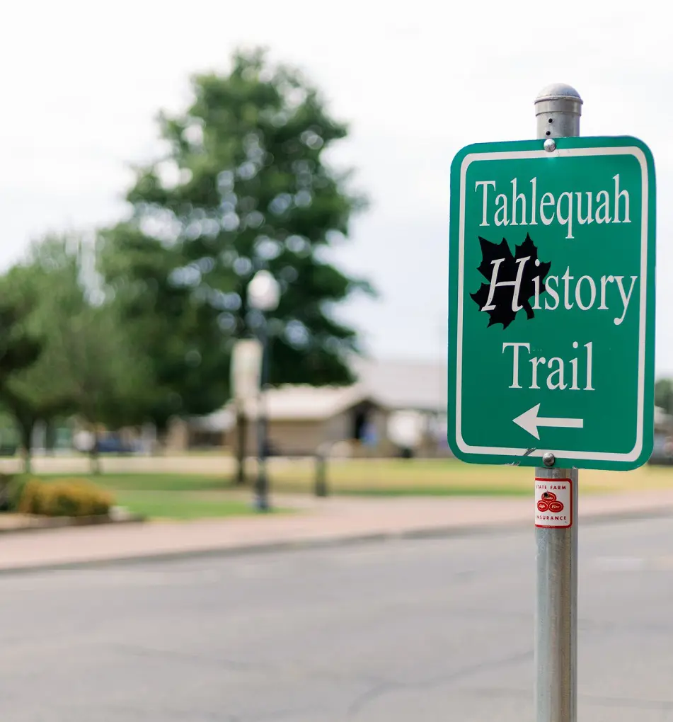
15. Downtown Tahlequah History Trail
- Distance: 2.7 km
- Elevation Gain: 24 m
- Route Type: Point-to-point
- Dog Friendly: Yes
- Difficulty Level: Easy
The Downtown Tahlequah History Trail is a 1.6-mile hike with an easy difficulty level that would take around half an hour to complete. Moreover, this paved hike follows the native heritage of the area as it winds through downtown Tahlequah, paralleling Bear Creek.
There are several of shaded rest spots along the path as it winds through the city's parks. The history of the local civilizations is brightened by informative markers along the trail. There are lights and emergency phones along the path.
In terms of accessibility, this route is probably open to users of wheelchairs, mobility aids, or strollers. Its surface is usually paved asphalt or concrete, with a minimum width of 10 feet.