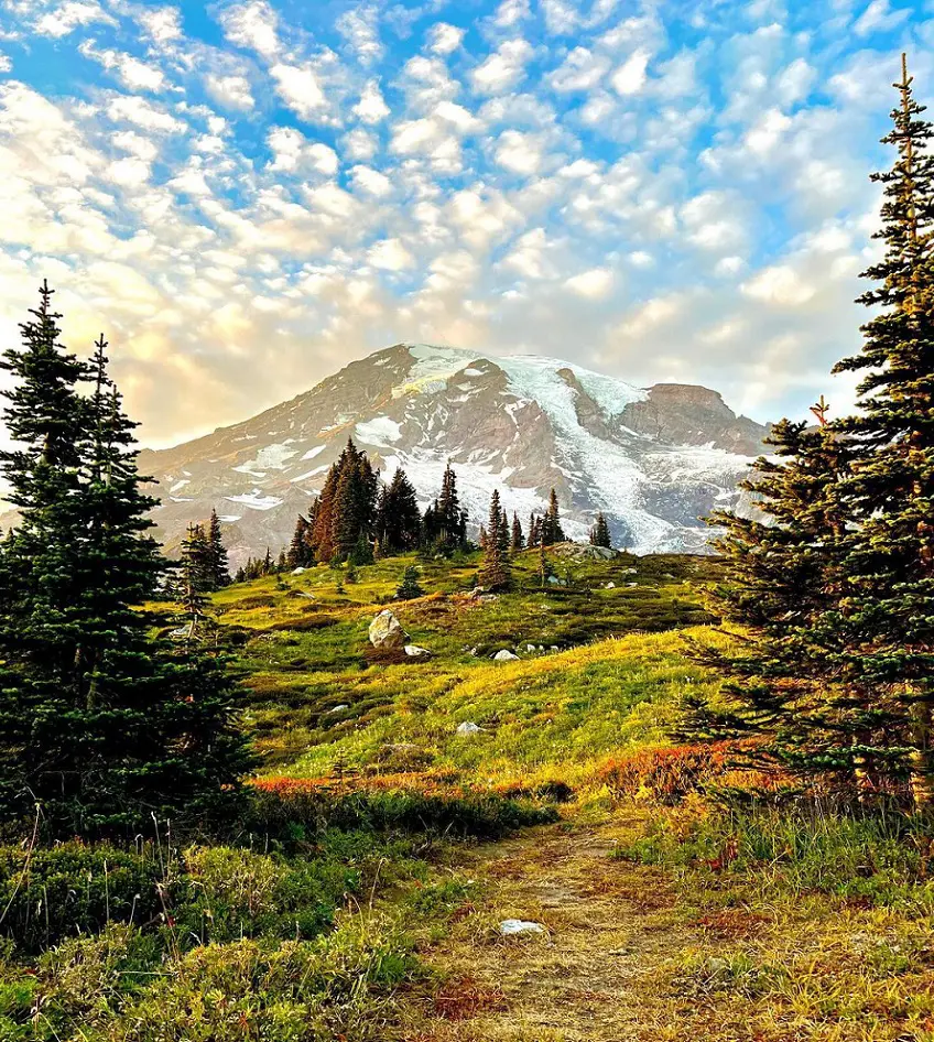
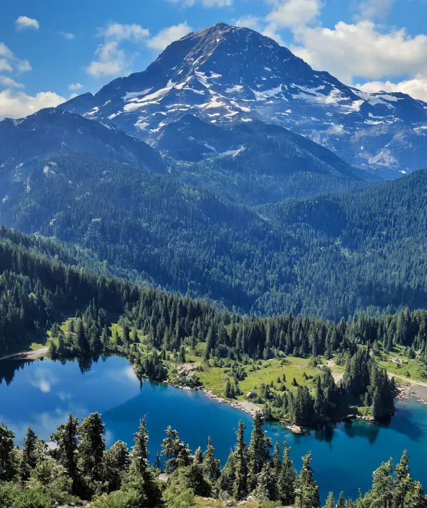
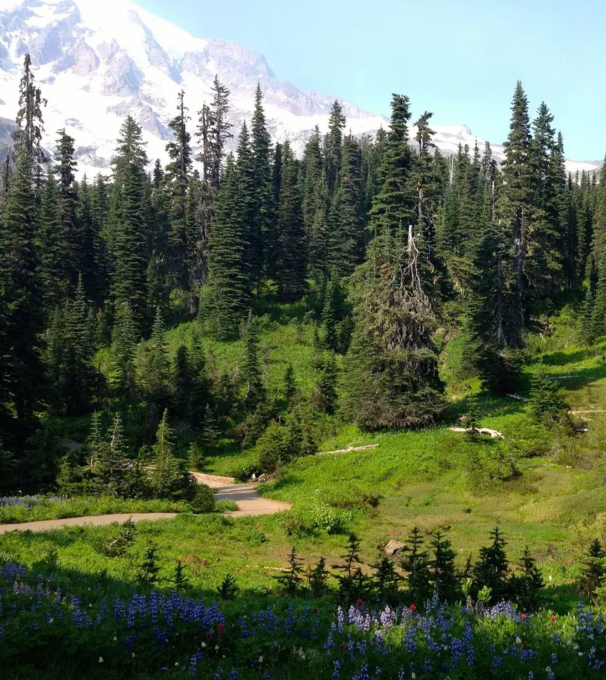
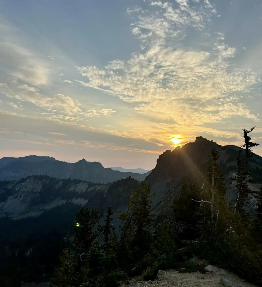
The Mount Rainier National Park, which is about 14,411 feet above sea level is a paradise for hikers and there are many things to explore. This huge national park is located in southeast Pierce County and northeast Lewis County in Washington state.
There are lots of hiking trails in MT Rainier National Park like Skyline Loop, Tolmie Peak Trail, Naches Peak Loop Trail, Silver Falls Loop, and many others. Hence, we have listed and tried to explain some of the best trails and hikes in Mount Rainier National Park with their difficulty level, length, and other details.
1. Skyline Loop
The Skyline Trail is the most well-traveled trail on Mount Rainier's southern flank. There is something for everyone on this loop: luxuriant greenery, views of glaciers, rivers, waterfalls, and breathtaking vistas of the surroundings. Although there are two ways to complete the loop, most people go in a clockwise orientation.
Many hikers reach Panorama Point and then turn around to return the way they came if they don't want to complete the entire round. Glacier Vista is an optional offshoot on the western side of the loop. There are views of the Nisqually Glacier from this detour. Whichever route you choose, you will begin at the Jackson Visitor Center.
- Distance: 9 km
- Elevation gain: 540 m
- Estimated time: 3h 28m
- Difficulty level: Hard
2. Panorama Point via Skyline Trail
This popular year-round trail offers stunning vistas of Mount Rainier and the neighboring mountains as it follows the Skyline Trail to Panorama Point.
Since the road to the trailhead is typically closed in the winter, you will need to extend this trek by cross-country skiing or snowshoeing along the route. Although August weather is usually good, it may be crowded and bug-filled. To avoid traffic and take in the landscape, it is best to start early.
- Distance: 6.3 km
- Elevation gain: 404 m
- Estimated time: 2h 31m
- Difficulty level: Hard
3. Tolmie Peak Trail
Situated in the historic Mount Rainier National Park on the north side of Mowich Lake, the Tolmie Peak Trail is a fantastic day hike that takes you past alpine lakes, through subalpine meadows, and up to a fire tower lookout. This trail is well worth the effort to reach the top, as it is among the best hiking trails in all of Washington.
The Tolmie Peak Fire Lookout, at the end of the journey, provides breathtaking views of Mount Rainier and the surrounding peaks in a broad panorama. The two-story building has storage on the first floor and a viewing station on the upper level.
This route begins by following the well-known Wonderland Trail and passes via Ipsut Pass before the major climbing starts.
- Distance: 9 km
- Elevation gain: 474 m
- Estimated time: 3h 16m
- Difficulty level: Moderate
4. Naches Peak Loop Trail
The Naches Loop path is the ideal family-friendly hikes Mt Rainier National Park if you're searching for something short. On the east side of Mount Rainier, the trailhead is located at the parking lot near the Stephen Tyng Mather Memorial.
The trail circles Naches Peak's east side before looping back around to meet it on the other side. At Tipsoo Lake, park.SR 410 5 miles west of Chinook Pass.
The Naches Peak Loop Trail can be hiked in a clockwise direction by tracing the route from the picnic spot to the Pacific Crest Trail and Chinook Pass. If you want extra and even better views of Mount Rainier, you might choose to trek up to Dewey Lake.
- Distance: 5.6 km
- Elevation gain: 201 m
- Estimated time: 1h 42m
- Difficulty level: Moderate
5. Burroughs Mountain Loop Trail
There are fantastic views of Mount Rainier on this hike, particularly from the second vista. There are several rocky parts along the generally sandy track. Frozen Lake and Shadow Lake are the two lakes you will pass on the route. Look out for wildlife, including black bears, pikas, and mountain goats.
Bring water and sunscreen because there isn't much shade. On the southern portion of the loop, Sunrise Camp is another place to camp. This is one of the several hiking trails in Mount Rainier National Park. Every overnight stay in the woods requires a wilderness permit.
Any travel over 10,000 feet or on glaciers requires a climbing permit. Although they are not necessary, reservations are advised. One day before your trip, you can register the remaining summer permits, which are provided on a first-come, first-served basis. Two-thirds of the permits (June to Sep) are available for advance registration.
- Distance: 15.3 km
- Elevation gain: 793 m
- Estimated time: 5h 28m
- Difficulty level: Hard
6. Silver Falls Loop
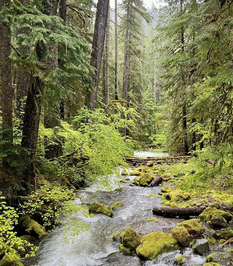
Take advantage of stunning views of Silver Falls as you stroll along this trail through the forest that runs parallel to the Ohanapecosh River. This is a beautiful family walk that runs around the rocky river in the canyon, giving the water its turquoise appearance due to the minerals in the water.
There are nearby year-round camping possibilities at the Ohanapecosh campground. Avoid entering the water close to the falls. Swimming here is risky due to the slick rocks and strong currents.
- Distance: 4.7 km
- Elevation gain: 159 m
- Estimated time: 1h 22m
- Difficulty level: Easy
7. Bench and Snow Lakes Trail
An excellent trip for new hikers, families with kids, or anybody simply enjoying gorgeous scenery is the Bench and Snow Lake Trail. On the west side of Stevens Canyon, "The Bench" is a comparatively flat, shelf-like landform formed by an eruption of lava some 91,000 years ago.
The path's initial section ascends to The Bench and passes through areas of subalpine meadow and huckleberry bushes before coming to a little spur trail that leads to Bench Lake. To get to Snow Lake, keep following the main trail, which includes some steeper log steps.
Snowmelt feeds Snow Lake, which is nestled into a Tatoosh Range cirque. This is one of the several hiking trails in Mount Rainier National Park. For all overnight stays in the backcountry, a wilderness permit is necessary.
- Distance: 3.5 km
- Elevation gain: 139 m
- Estimated time: 1h 6m
- Difficulty level: Moderate
8. Skyline and Golden Gate Loop
Two popular hiking trails in Mount Rainier National Park are followed by this loop. To get to Golden Gates Falls, hike up the Skyline Trail to Myrtle Falls and then join the Golden Gates Trail. Follow the Skyline Trail as it re-joins and circles back to the trailhead.
There are stunning views of Mount Rainier and the surroundings from this walk. In addition, August usually brings pleasant weather and gorgeous wildflowers, but be ready for crowds and insects.
- Distance: 6.1 km
- Elevation gain: 339 m
- Estimated time: 2h 15m
- Difficulty level: Moderate
9. Nisqually Vista Trail
This kid-friendly trail leads to the Jackson Visitor Center after a short stroll and offers stunning views of Nisqually Glacier. Snowfall is possible in June and July. This trail is wheelchair-accessible but not stroller accessible because of a stairway at the beginning.
Warm temperatures, an abundance of greenery, blossoming wildflowers, and occasional outbreaks of mosquitoes are possible characteristics of August weather. It can be difficult to get parking during busy times.
- Distance: 1.8 km
- Elevation gain: 55 m
- Estimated time: 0h 30m
- Difficulty level: Easy
10. Comet Falls via Van Trump Trail
The trail features a variety of scenery, including meadows, waterfalls, bridges, running rivers and creeks, and Mount Rainier in the distance. Comet Falls hike is a moderately steep, well-maintained trail. The Comet Falls itself is a magnificent cascade that becomes much more stunning up close.
In the winter, the road leading to the trailhead can be hazardous. There isn't much room in the lot for parking, therefore it's on Paradise Road.
Although the walk has a lot of steps and is difficult, it offers serene beauty and distinct microclimates. August is usually warm with the possibility of rain, which can improve views of waterfalls.
- Distance: 5.6 km
- Elevation gain: 392 m
- Estimated time: 2h 21m
- Difficulty level: Hard
11. Rampart Ridge Loop
This gentle loop travels through woodlands while offering views of the nearby mountain ranges. This ridge also referred to as "The Ramparts," is the remnants of an old lava flow that started at Mount Rainier's peak.
Starting in a clockwise direction, the trail starts at the west end of the Trail of the Shadows, about 0.2 kilometers from the trailhead.
Although hiking the loop may be done in any direction, it is advised to go clockwise because it keeps Mount Rainier in view most of the time. Ascend through an ancient woodland to reach the summit of Rampart Ridge.
- Distance: 7.7 km
- Elevation gain: 432 m
- Estimated time: 2h 52m
- Difficulty level: Moderate
12. Burroughs Mountain Trail
Hiking this trail offers unparalleled views of Mount Rainier and the surrounding mountains and leads to the most accessible tundra in the Cascade Range. Please make sure you stay on the route because of the delicate habitat. There is hardly much shade along this ridge line walk.
Bring plenty of water and protection from the sun. This is one of the best hikes in Mount Rainier National Park. Every overnight stay in the woods requires a wilderness permit. Any travel over 10,000 feet or on glaciers requires a climbing permit.
- Distance: 14.3 km
- Elevation gain: 743 m
- Estimated time: 5h 7m
- Difficulty level: Hard
13. Narada Falls
It's a quick stroll to the Narada Falls overlook. If you don't want to hike, you can still see the falls from the top pullout. At 150 feet, this is the park's tallest waterfall that can be seen from a car. The park's architecture, including the bridge, originated in the early 1900s.
You can go all the way to Carter and Madcap Falls on the Wonderland Trail if you want to extend your hike. Despite being brief, the route can get congested, especially during busy hours.
- Distance: 0.3 km
- Elevation gain: 18 m
- Estimated time: 0h 8m
- Difficulty level: Moderate
14. Muir Snowfield Ski Tour
In the winter, spring, and early summer, the Muir Snowfield on the southeast face of Mount Rainier provides some of the longest ski descents in the Cascades. Backcountry skiers and riders can start at 5400 feet in Paradise and trek to Camp Muir, which is nearly 10,000 feet above sea level.
From there, they can enjoy the wide snowfield and carve turns down its mild slopes down to Paradise. Choose your weather and routes carefully in the winter, as the snowfield can frequently be obscured by clouds on snowy days. Late spring and early summer see a wide variation in the amount of snow cover.
- Distance: 13.5 km
- Elevation gain: 1,419 m
- Estimated time: 7h 21m
- Difficulty level: Hard
15. Green Lake Trail
This lovely hike leads to a pristine alpine lake in the Carbon River area by passing through amazing scenery. You are rewarded with a glimpse of the majestic Mt. Rainier rising over Green Lake, nestled inside the undulating Cascades.
This easy walk offers a great hike amongst enormous mountains, largely in the river floodplain. Heavy precipitation events can have an influence on this area during the winter. Be ready to navigate typical wet season difficulties such as road and path washouts, fallen trees, and snow if you visit this trail in the winter.
- Distance: 14.5 km
- Elevation gain: 447 m
- Estimated time: 4h 6m
- Difficulty level: Moderate
16. Emmons Moraine Trail
Beautiful, simple, and well-kept is the Glacier Basin trail. You come to a fork at less than a mile and bear left. You can cross after a little stroll to a log that has been converted into a footbridge. There are a few overlooks immediately after, and then you'll ascend the crest via a few short switchbacks.
You get great views of the stunning turquoise runoff lake and the top of the glacier, which seems to be a rock wall due to a debris fall that covered it in rocks. This is not an awful location to go back.
- Distance: 6.8 km
- Elevation gain: 285 m
- Estimated time: 2h 11m
- Difficulty level: Moderate
17. Glacier Basin Trail
In the late 1800s, attempts were made to mine copper ore in this region, but no valuable material was ever produced, and mining activities were finally abandoned. For three and a half miles, the trail hugs the White River. There's a junction with the Emmons Moraine Trail one mile past the trailhead.
The largest glacier in the 48 contiguous United States, Emmons Glacier, is seen from a viewpoint reached by a one-mile round-trip spur walk. The ascent is moderate at first, but at the end, as you approach Glacier Basin, it gets steeper. This is one of the several hiking trails in Mount Rainier National Park.
- Distance: 13 km
- Elevation gain: 715 m
- Estimated time: 4h 48m
- Difficulty level: Moderate
18. Sunrise Rim Trail
North of the Sunrise parking lot, the Sunrise Nature Trail winds across subalpine meadows. Cool, breathtaking vistas of Mount Rainier, with Mount Baker, Glacier Peak, and Mount Adams in the distance, may be experienced with a moderate hike to the ridge's summit.
To save delicate flora, stick to the path. There is sometimes a chance to spot Rocky Mountain goats on the trail. Sunrise, located at an elevation of 6,400 feet, is the highest point in Mount Rainier National Park that is accessible by car.
Sunrise is the park's second-most popular destination because of its breathtaking views and well-designed trail system.
- Distance: 8 km
- Elevation gain: 336 m
- Estimated time: 2h 35m
- Difficulty level: Moderate
19. Pinnacle Peak Trail
The widely recognized Pinnacle Peak Trail begins south of Reflection Lakes. In the Tatoosh Range, the rocky trail ascends 1,050 feet over many switchbacks through subalpine meadows to a saddle situated between Pinnacle Peak and Plummer Peak.
The trail occasionally has steep, exposed drop-offs and areas of snow that last long into summer. From the saddle, you can see Mount Rainier to the north and Mount Adams and Mount St. Helens to the south.
- Distance: 4.7 km
- Elevation gain: 483 m
- Difficulty level: Hard
20. Trail of the Shadows
These trails on Mt Rainier path circle Longmire Meadow Springs, and along the straightforward Trail of the Shadows, human and natural history converge in Longmire's forests and meadows. In Longmire, the National Park Inn is across the main road from the trailhead.
Experience a 0.7-mile stretch of raging natural springs and learn about the flora and fauna that live here, such as birds, beavers, and deer. At the south end of the route, by the National Park Inn and Longmire Museum, there is a paved parking area off Paradise Road with at least 4 approved accessible places.
- Distance: 1.1 km
- Elevation gain: 12 m
- Estimated time: 0h 14m
- Difficulty level: Easy